
A set of maps visualizing a possible future for mass transit in the greater Edmonton area.
☞ information design, cartography
☞ personal project
Context
Over the years, I’ve grown to love Edmonton as my hometown and to embrace the dynamic, big-city mindset of growth that currently seems to characterize it. One of the hallmarks of dense urban areas is the development of mass transit, which Edmonton is seeing, if slowly. And along with a maturing and increasingly complex transit system comes the need to efficiently navigate it through the use of visual aids, such as maps and wayshowing devices. The diagrammatic simplification of transit cartography, in particular, is useful in the planning of trips and commutes.
Process
Being one of my passion projects, I worked through numerous iterations of Edmonton LRT maps over the span of two years, ranging from wildly fantastical and unfeasible to more plausible and with precedent. Much of this time was spent researching Edmonton’s human geography, history, communities, and naming conventions, as well as combing through official city planning documents.
Concept
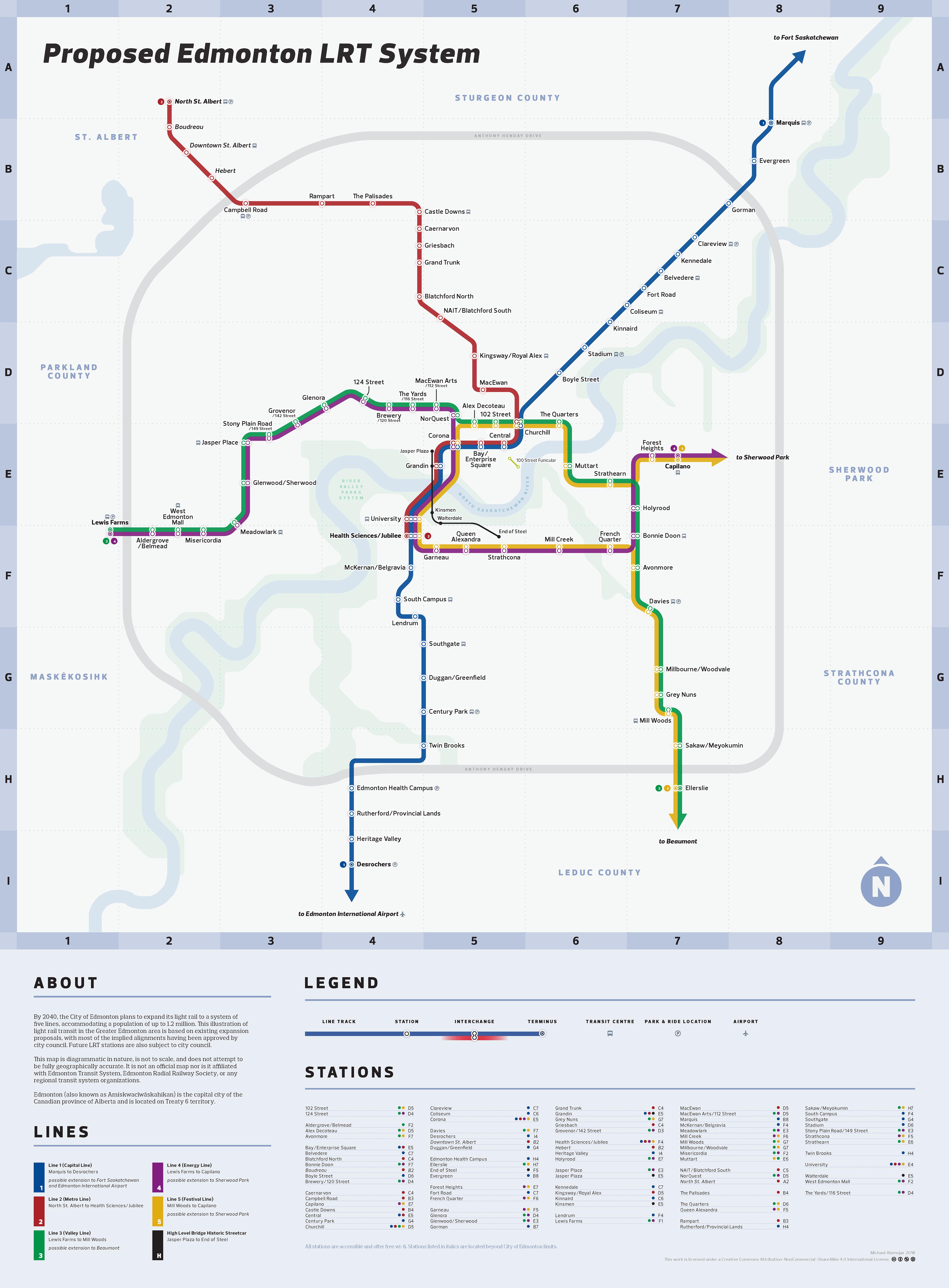
Two main versions of the map exist: a more detailed iteration for users with higher time affordances and a more simplified version designed with more emphasis on quick practicality. Both share the same diagrammatic visual language, but each lends itself better to different use cases.
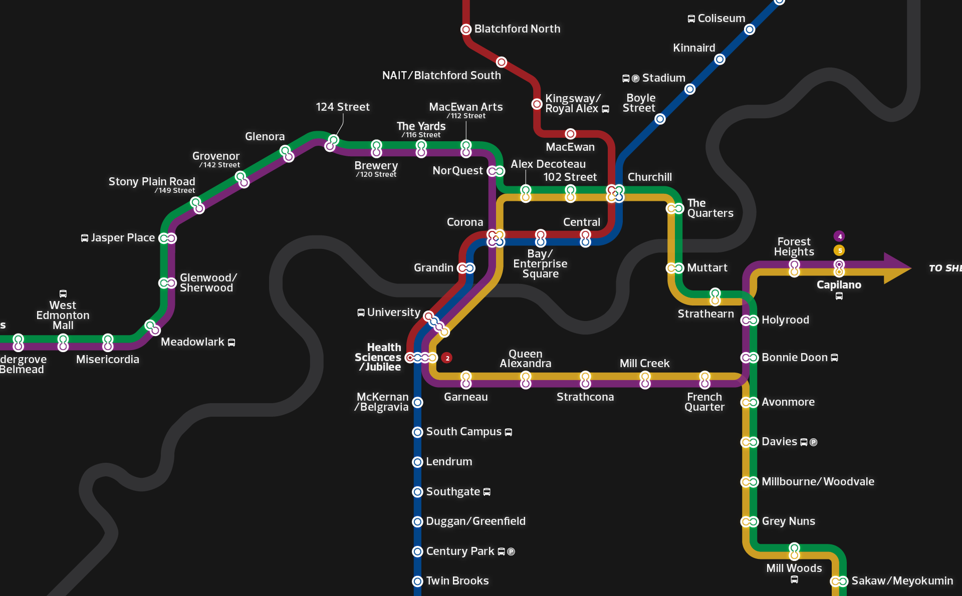
The first map uses an explicit grid system and a number of geographical cues to help users contextualize the hypothetical system. Together with a line legend, a station index, and a short explanation, the information provided aims to help users conceptualize and engage with the possibility of light rail development in Edmonton.
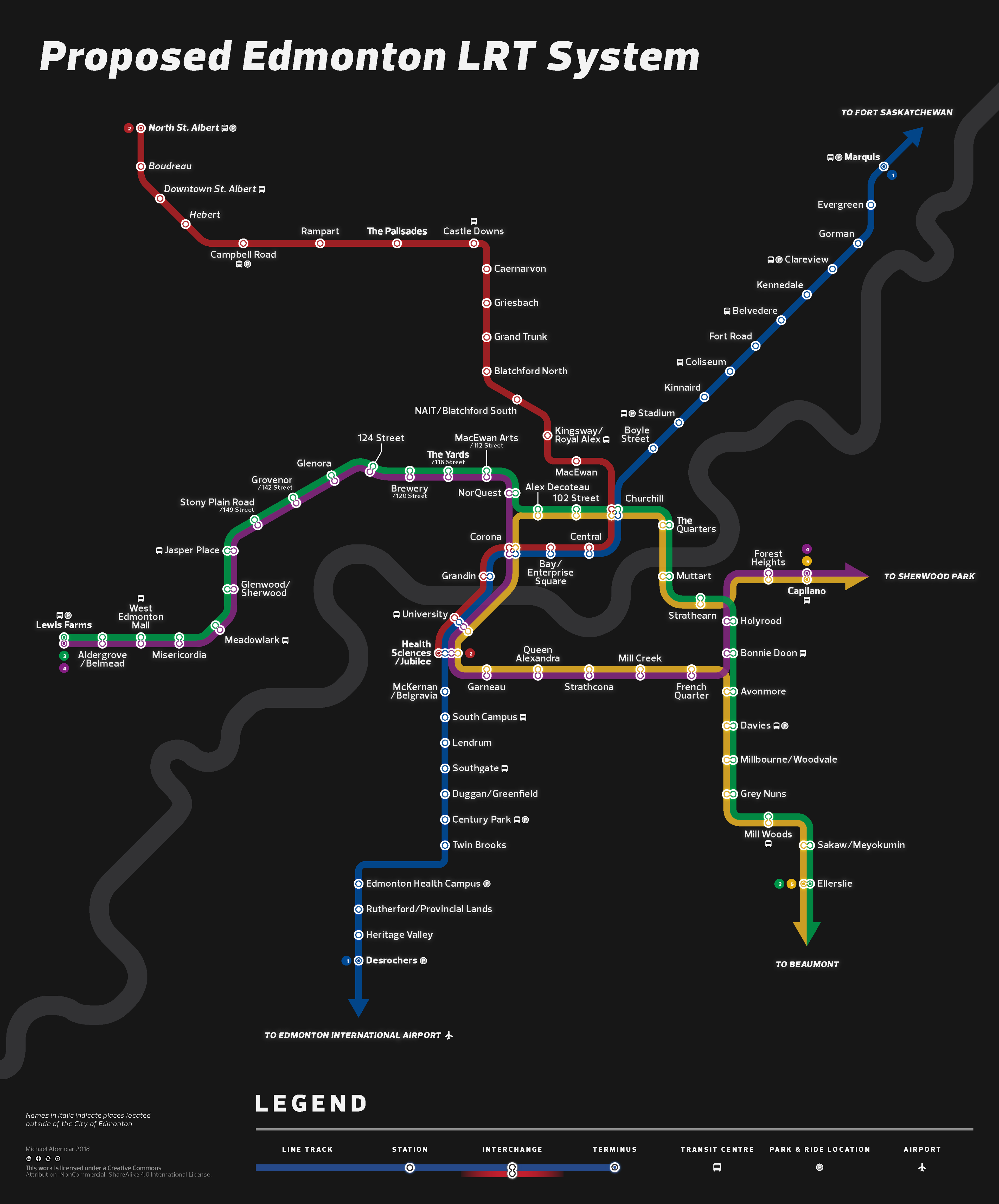
The second of the set pares the visual information down to more essential components, making it better suited to situations that call for quick reference. This use case might be one seen after the system was built out, used by commuters on the go in order to monitor and make decisions about their route. A black background is used in the tradition of preceding Canadian transit maps, such as Société de transport de Montréal’s Metro map and Toronto Transit Commission’s subway map.